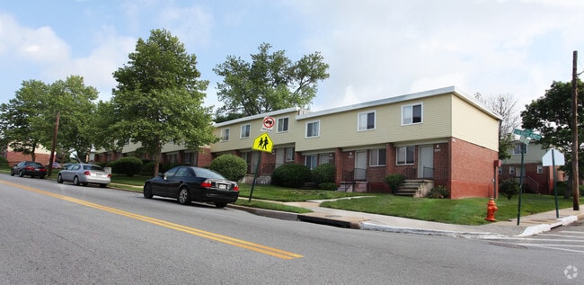
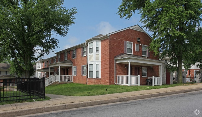
Property Record
3520 Spelman Rd, Brooklyn, MD 21225
NEARBY LISTINGS FOR SALE OR LEASE
Property Detail
3520 Spelman Rd
Baltimore-Columbia-Towson, MD
12.174 ACRES
7624-002
Baltimore City
Commercialnec
Maryland
X
2
2400100510H
12.17 AC
2023
Cherry Hill
2025
Baltimore
750102
DEMOGRAPHICS near 3520 Spelman Rd
1 Mile
3 Mile
5 Mile
2024 Total Population
8,296
119,716
386,702
2029 Population
7,894
117,377
380,855
Pop Growth 2024-2029
(4.85%)
(1.95%)
(1.51%)
Average Age
35
36
38
2024 Total Households
3,214
50,461
164,123
HH Growth 2024-2029
(5.07%)
(2.33%)
(1.92%)
Median Household Inc
$28,148
$64,581
$55,698
Avg Household Size
2.50
2.30
2.20
2024 Avg HH Vehicles
1.00
1.00
1.00
Median Home Value
$170,097
$237,995
$229,375
Median Year Built
1953
1953
1951
Nearby Places
Map Layers
Map Styles
 Street
 Aerial
- Restaurants
- Banks
- Shops
- Fitness
- Groceries
PUBLIC TRANSPORTATION
COMMUTER RAIL
Camden Station (CAMDEN - WASHINGTON - Maryland Area Regional Commuter Trains (The MARC), Camden Line - Maryland Area Regional Commuter Trains (The MARC))
DRIVE
WALK
Distance
Camden Station (CAMDEN - WASHINGTON - Maryland Area Regional Commuter Trains (The MARC), Camden Line - Maryland Area Regional Commuter Trains (The MARC))
10 min
4.4 mi
Halethorpe Marc Nb (PENN - WASHINGTON - Maryland Transit Administration)
DRIVE
WALK
Distance
Halethorpe Marc Nb (PENN - WASHINGTON - Maryland Transit Administration)
15 min
6.9 mi
AIRPORT
Baltimore/Washington International Thurgood Marshall
DRIVE
WALK
Distance
Baltimore/Washington International Thurgood Marshall
15 min
6.0 mi
Freight Ports
Port of Baltimore
DRIVE
WALK
Distance
Port of Baltimore
10 min
3.9 mi
Nearby Properties
Address
Land Use
TOTAL SIZE
Lot Size
Zoning
Address
Land Use
TOTAL SIZE
Lot Size
Zoning
308,887 SF
3.98 AC
C-5DC
Address
Land Use
TOTAL SIZE
Lot Size
Zoning
467.03 AC
W2
Address
Land Use
TOTAL SIZE
Lot Size
Zoning
642,817 SF
1.91 AC
PC-2
Address
Land Use
TOTAL SIZE
Lot Size
Zoning
520,407 SF
16.85 AC
H
Address
Land Use
TOTAL SIZE
Lot Size
Zoning
309,558 SF
3.01 AC
C-2
Address
Land Use
TOTAL SIZE
Lot Size
Zoning
528,399 SF
0.21 AC
TOD-4
Address
Land Use
TOTAL SIZE
Lot Size
Zoning
315,605 SF
1.80 AC
Address
Land Use
TOTAL SIZE
Lot Size
Zoning
442,145 SF
2.30 AC
C-2
Address
Land Use
TOTAL SIZE
Lot Size
Zoning
383,697 SF
68.35 AC
R5
Address
Land Use
TOTAL SIZE
Lot Size
Zoning
1,105,167 SF
6.35 AC
C-5DC
Address
Land Use
TOTAL SIZE
Lot Size
Zoning
289,829 SF
24.56 AC
C3
Address
Land Use
TOTAL SIZE
Lot Size
Zoning
234,439 SF
1.02 AC
Address
Land Use
TOTAL SIZE
Lot Size
Zoning
290,000 SF
1.51 AC
PC-2
Address
Land Use
TOTAL SIZE
Lot Size
Zoning
19.20 AC
R15
Address
Land Use
TOTAL SIZE
Lot Size
Zoning
12.90 AC
R15
Address
Land Use
TOTAL SIZE
Lot Size
Zoning
233,408 SF
24.73 AC
C3
Address
Land Use
TOTAL SIZE
Lot Size
Zoning
132,655 SF
0.74 AC
Address
Land Use
TOTAL SIZE
Lot Size
Zoning
263,024 SF
6.87 AC
C3
Address
Land Use
TOTAL SIZE
Lot Size
Zoning
18.86 AC
DR16
Address
Land Use
TOTAL SIZE
Lot Size
Zoning
73,080 SF
6.34 AC
C-5DC
Address
Land Use
TOTAL SIZE
Lot Size
Zoning
173,735 SF
17.31 AC
PC-4
Address
Land Use
TOTAL SIZE
Lot Size
Zoning
374,715 SF
2.96 AC
C-2
Address
Land Use
TOTAL SIZE
Lot Size
Zoning
16.26 AC
R15
Address
Land Use
TOTAL SIZE
Lot Size
Zoning
15.05 AC
R15
Address
Land Use
TOTAL SIZE
Lot Size
Zoning
239,476 SF
19.02 AC
MI
Address
Land Use
TOTAL SIZE
Lot Size
Zoning
12 AC
C3
Address
Land Use
TOTAL SIZE
Lot Size
Zoning
68,150 SF
0.96 AC
C-2
Address
Land Use
TOTAL SIZE
Lot Size
Zoning
101,220 SF
17.51 AC
DR5.5
Address
Land Use
TOTAL SIZE
Lot Size
Zoning
190,650 SF
20.80 AC
I-2
Address
Land Use
TOTAL SIZE
Lot Size
Zoning
393,126 SF
2.18 AC
OR-2
The World's #1 Commercial Real Estate Marketplace
Connect with us
© 2026 CoStar Group
The information above has been obtained from sources believed reliable. While we do not doubt its accuracy we have not verified it and make no guarantee, warranty or representation about it. It is your responsibility to independently confirm its accuracy and completeness. Any projections, opinions, assumptions, or estimates used are for example only and do not represent the current or future performance of the property. The value of this transaction to you depends on tax and other factors which should be evaluated by your tax, financial, and legal advisors. You and your advisors should conduct a careful, independent investigation of the property to determine to your satisfaction the suitability of the property for your needs.